Geolocate

Coca topographic map

Click on the map to display elevation.

About this map

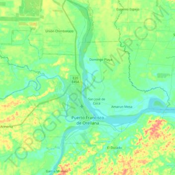
Name: Coca topographic map, elevation, terrain.

Location: Coca, Francisco de Orellana, Orellana, Ecuador (-0.49964 -77.08287 -0.37492 -76.89554)

Average elevation: 866 ft

Minimum elevation: 784 ft

Maximum elevation: 1,050 ft

Gear up for your next adventure:

📶Satellite Messenger - Communication device off‑grid
🎒Waterproof Dry Bags - Keep your electronics and maps dry inside your pack
🏔️Mountain Trail Maps - High‑detail maps for popular peaks
🪄Magnetic Compass - Accurate compass for navigation
🧯Portable Fire Pit - Compact fire pit for camping spots

As an Amazon Associate, this site earns from qualifying purchases at no extra cost to you.