
Thank you for supporting this site ❤️
Make a donation
Make a donation
Gear up for your next adventure:
As an Amazon Associate, this site earns from qualifying purchases at no extra cost to you.
Balshigwadi topographic map
Click on the map to display elevation.
Thank you for supporting this site ❤️
Make a donation
Make a donation
Gear up for your next adventure:
As an Amazon Associate, this site earns from qualifying purchases at no extra cost to you.
About this map
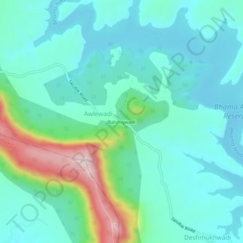
Name: Balshigwadi topographic map, elevation, terrain.
Location: Balshigwadi, Awlewadi, Khed, Maharashtra, India (18.86240 73.62253 18.90240 73.66253)
Average elevation: 2,411 ft
Minimum elevation: 2,133 ft
Maximum elevation: 3,425 ft
Thank you for supporting this site ❤️
Make a donation
Make a donation
Gear up for your next adventure:
As an Amazon Associate, this site earns from qualifying purchases at no extra cost to you.