
Thank you for supporting this site ❤️
Make a donation
Make a donation
Gear up for your next adventure:
As an Amazon Associate, this site earns from qualifying purchases at no extra cost to you.
Carrascal topographic map
Click on the map to display elevation.
Thank you for supporting this site ❤️
Make a donation
Make a donation
Gear up for your next adventure:
As an Amazon Associate, this site earns from qualifying purchases at no extra cost to you.
About this map
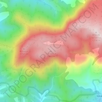
Name: Carrascal topographic map, elevation, terrain.
Location: Carrascal, Urraúl Alto, Pirinioaurrea / Prepirineo, Spain (42.80282 -1.19109 42.80292 -1.19099)
Average elevation: 3,182 ft
Minimum elevation: 2,457 ft
Maximum elevation: 3,957 ft
Thank you for supporting this site ❤️
Make a donation
Make a donation
Gear up for your next adventure:
As an Amazon Associate, this site earns from qualifying purchases at no extra cost to you.