
Make a donation
Gear up for your next adventure:
As an Amazon Associate, this site earns from qualifying purchases at no extra cost to you.
San Pedro de Los Altos topographic map
Click on the map to display elevation.
Make a donation
Gear up for your next adventure:
As an Amazon Associate, this site earns from qualifying purchases at no extra cost to you.
About this map
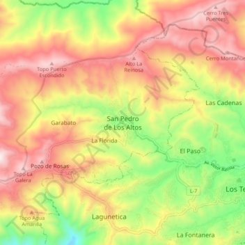
Name: San Pedro de Los Altos topographic map, elevation, terrain.
Average elevation: 4,551 ft
Minimum elevation: 3,159 ft
Maximum elevation: 5,781 ft
Make a donation
Gear up for your next adventure:
As an Amazon Associate, this site earns from qualifying purchases at no extra cost to you.
Other topographic maps
Click on a map to view its topography, its elevation and its terrain.
Parque Nacional Macarao
Venezuela > Estado Miranda > Municipio Guaicaipuro
Average elevation: 5,059 ft
Parroquia Los Teques
Venezuela > Estado Miranda > Municipio Guaicaipuro
Los Teques es la ciudad capital del Estado Miranda y del Municipio Guaicaipuro. Está ubicada en la Región Capital en el centro-norte de Venezuela. Específicamente, al SO de Caracas, a 10°21′00″ de latitud N y a 67°02′30″ de longitud O de Greenwich, a una altitud de 1169 m sobre el nivel del mar.…
Average elevation: 3,376 ft
Los Cujíes
Venezuela > Estado Miranda > Municipio Guaicaipuro > Los Cujíes
Average elevation: 1,732 ft