
Thank you for supporting this site ❤️
Make a donation
Make a donation
Gear up for your next adventure:
As an Amazon Associate, this site earns from qualifying purchases at no extra cost to you.
Mutshatsha topographic map
Click on the map to display elevation.
Thank you for supporting this site ❤️
Make a donation
Make a donation
Gear up for your next adventure:
As an Amazon Associate, this site earns from qualifying purchases at no extra cost to you.
About this map
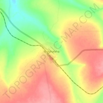
Name: Mutshatsha topographic map, elevation, terrain.
Location: Mutshatsha, Lualaba, Democratic Republic of the Congo (-10.68328 24.42096 -10.60328 24.50096)
Average elevation: 4,052 ft
Minimum elevation: 3,878 ft
Maximum elevation: 4,193 ft
Thank you for supporting this site ❤️
Make a donation
Make a donation
Gear up for your next adventure:
As an Amazon Associate, this site earns from qualifying purchases at no extra cost to you.