Geolocate

Okada topographic map

Click on the map to display elevation.

About this map
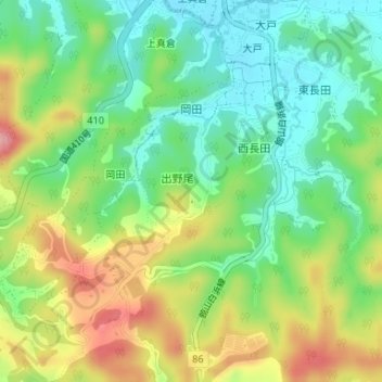
Name: Okada topographic map, elevation, terrain.

Location: Okada, Tateyama, Chiba Prefecture, 294-0024, Japan (34.95259 139.85297 34.97003 139.87478)

Average elevation: 197 ft

Minimum elevation: 23 ft

Maximum elevation: 456 ft

Gear up for your next adventure:

🎒Waterproof Dry Bags - Keep your electronics and maps dry inside your pack
🧦Hiking Socks - Comfortable socks to prevent blisters on long hikes
🪶LED Camping Lantern - Bright lantern for camp lighting
🪑Ultralight Camp Chairs - Portable seating for resting after a long day of mapping
🌎3D Topographic Globes - Raised relief globes for a tactile understanding of geography

As an Amazon Associate, this site earns from qualifying purchases at no extra cost to you.