Geolocate

Burrow topographic map

Click on the map to display elevation.

About this map

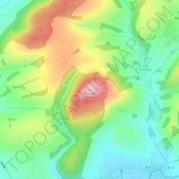
Name: Burrow topographic map, elevation, terrain.

Location: Burrow, Hopesay, Shropshire, England, SY7 8HA, United Kingdom (52.44219 -2.91191 52.44229 -2.91181)

Average elevation: 715 ft

Minimum elevation: 440 ft

Maximum elevation: 1,155 ft

Gear up for your next adventure:

🦺Reflective Outdoor Gear - Safety gear for low‑light conditions
🪵Folding Camp Saw - Compact saw for wood and campsite work
🛰️Handheld GPS Units - Professional satellite navigators for precise backcountry mapping
Camping Coffee Makers - Enjoy premium coffee at the summit or campsite
🔥Plasma Lighters - Windproof lighters that work in any weather condition

As an Amazon Associate, this site earns from qualifying purchases at no extra cost to you.