
Thank you for supporting this site ❤️
Make a donation
Make a donation
Gear up for your next adventure:
As an Amazon Associate, this site earns from qualifying purchases at no extra cost to you.
Chavarrillo topographic map
Click on the map to display elevation.
Thank you for supporting this site ❤️
Make a donation
Make a donation
Gear up for your next adventure:
As an Amazon Associate, this site earns from qualifying purchases at no extra cost to you.
About this map
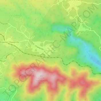
Name: Chavarrillo topographic map, elevation, terrain.
Location: Chavarrillo, Emiliano Zapata, Veracruz, México (19.40528 -96.81139 19.44528 -96.77139)
Average elevation: 2,900 ft
Minimum elevation: 2,096 ft
Maximum elevation: 3,786 ft
Thank you for supporting this site ❤️
Make a donation
Make a donation
Gear up for your next adventure:
As an Amazon Associate, this site earns from qualifying purchases at no extra cost to you.