
Calcutt topographic map
Click on the map to display elevation.
About this map
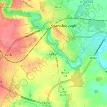
Name: Calcutt topographic map, elevation, terrain.
Average elevation: 203 ft
Minimum elevation: 89 ft
Maximum elevation: 328 ft
Other topographic maps
Click on a map to view its topography, its elevation and its terrain.
Knaresborough Forest Park
United Kingdom > England > North Yorkshire > Knaresborough > Calcutt
Average elevation: 249 ft