Geolocate

Lockington topographic map

Click on the map to display elevation.

About this map

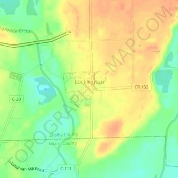
Name: Lockington topographic map, elevation, terrain.

Location: Lockington, Shelby County, Ohio, United States (40.20423 -84.23903 40.20962 -84.23282)

Average elevation: 928 ft

Minimum elevation: 856 ft

Maximum elevation: 984 ft

Shelby County trails, hiking, mountain biking, running and outdoor activities

Other topographic maps

Click on a map to view its topography, its elevation and its terrain.

Mount Jefferson

United States > Ohio > Shelby County

Average elevation: 965 ft

Maplewood

United States > Ohio > Shelby County

Average elevation: 1,040 ft

Gear up for your next adventure:

🪶Paracord Bracelet - Survival bracelet with built‑in tools
🪓Survival Multi‑Tool - Versatile tool for camp and trail tasks
🪑Portable Camp Table - Compact table for campsite meals
🔦LED Headlamp - Bright and durable LED headlamp for night navigation
Solar GPS Watches - Advanced multisport watches with built-in topographic maps

As an Amazon Associate, this site earns from qualifying purchases at no extra cost to you.