
Thank you for supporting this site ❤️
Make a donation
Make a donation
Gear up for your next adventure:
As an Amazon Associate, this site earns from qualifying purchases at no extra cost to you.
Sigsiloma topographic map
Click on the map to display elevation.
Thank you for supporting this site ❤️
Make a donation
Make a donation
Gear up for your next adventure:
As an Amazon Associate, this site earns from qualifying purchases at no extra cost to you.
About this map
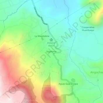
Name: Sigsiloma topographic map, elevation, terrain.
Location: Sigsiloma, Angochagua, Ibarra, Imbabura, 100152, Ecuador (0.22658 -78.11794 0.26658 -78.07794)
Average elevation: 9,442 ft
Minimum elevation: 8,481 ft
Maximum elevation: 11,243 ft
Thank you for supporting this site ❤️
Make a donation
Make a donation
Gear up for your next adventure:
As an Amazon Associate, this site earns from qualifying purchases at no extra cost to you.