
青海 topographic map
Interactive map
Click on the map to display elevation.
About this map
Name: 青海 topographic map, elevation, terrain.
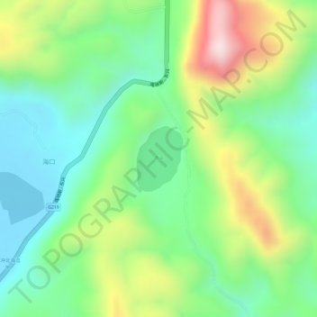
Location: 青海, 腾冲市, 云南省, 中国 (25.12941 98.57017 25.13497 98.57453)
Average elevation: 6,188 ft
Minimum elevation: 5,673 ft
Maximum elevation: 7,031 ft
坐标:25°7′56″N 98°34′20″E / 25.13222°N 98.57222°E / 25.13222; 98.57222 青海又名澄鏡池,是位於中華人民共和國雲南省騰沖市北海乡雙海村的一個火山湖,是中国唯一的自然酸性湖,屬於大盈江流域。湖面海拔为1885米时,面积0.21平方公里,最大水深为5.9米。南部湖水pH值平均值為5.8。湖水主要靠大盈江流域径流和地下水補給。
Other topographic maps
Click on a map to view its topography, its elevation and its terrain.