Geolocate

Zeetze topographic map

Click on the map to display elevation.

About this map

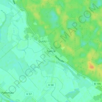
Name: Zeetze topographic map, elevation, terrain.

Location: Zeetze, Amt Neuhaus, Lüneburg, Lower Saxony, Germany (53.20900 10.96583 53.24900 11.00583)

Average elevation: 43 ft

Minimum elevation: 16 ft

Maximum elevation: 102 ft

Gear up for your next adventure:

🛌Ultralight Sleeping Bags - Compact down bags for cold nights in the wilderness
🥄Camping Utensil Set - Lightweight utensils for outdoor meals
🪑Ultralight Camp Chairs - Portable seating for resting after a long day of mapping
🚗GPS Dash Cams - Record your scenic drives through mountain passes and canyons
🚪Portable Camp Chair - Foldable chair for comfort at camp

As an Amazon Associate, this site earns from qualifying purchases at no extra cost to you.