
Thank you for supporting this site ❤️
Make a donation
Make a donation
Gear up for your next adventure:
As an Amazon Associate, this site earns from qualifying purchases at no extra cost to you.
Semnan topographic map
Click on the map to display elevation.
Thank you for supporting this site ❤️
Make a donation
Make a donation
Gear up for your next adventure:
As an Amazon Associate, this site earns from qualifying purchases at no extra cost to you.
About this map
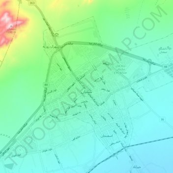
Name: Semnan topographic map, elevation, terrain.
Location: Semnan, بخش مرکزی سمنان, Semnan County, Semnan Province, Iran (35.53853 53.33403 35.62026 53.46076)
Average elevation: 3,839 ft
Minimum elevation: 3,488 ft
Maximum elevation: 5,210 ft
Thank you for supporting this site ❤️
Make a donation
Make a donation
Gear up for your next adventure:
As an Amazon Associate, this site earns from qualifying purchases at no extra cost to you.