
Wang Pong topographic map
Interactive map
Click on the map to display elevation.
About this map
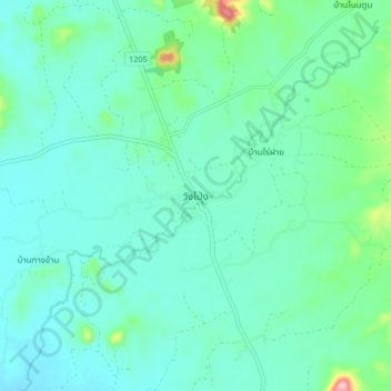
Name: Wang Pong topographic map, elevation, terrain.
Location: Wang Pong, Phetchabun Province, Thailand (16.28887 100.76006 16.36887 100.84006)
Average elevation: 384 ft
Minimum elevation: 282 ft
Maximum elevation: 860 ft
Other topographic maps
Click on a map to view its topography, its elevation and its terrain.
Ban Nong Chaeng
Thailand > Phetchabun Province
Ban Nong Chaeng, Ban Phot, Phetchabun Province, Thailand
Average elevation: 276 ft
Phetchabun
Thailand > Phetchabun Province
Phetchabun, Phetchabun Province, 67000, Thailand
Average elevation: 394 ft