Geolocate

Kishtwar topographic map

Click on the map to display elevation.

About this map

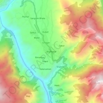
Name: Kishtwar topographic map, elevation, terrain.

Location: Kishtwar, Jammu and Kashmir, 182204, India (33.27079 75.72942 33.35079 75.80942)

Average elevation: 6,348 ft

Minimum elevation: 3,373 ft

Maximum elevation: 10,548 ft

Gear up for your next adventure:

☀️Outdoor Sunscreen - High protection sunscreen for outdoor activities
🎒Trail Energy Bars - High‑calorie bars for hiking energy
📶Vehicle Signal Boosters - Improve reception in rural areas while driving to trailheads
🏫Relief Map Kits - Hands-on tools for teaching landforms and elevation
🚪Portable Camp Chair - Foldable chair for comfort at camp

As an Amazon Associate, this site earns from qualifying purchases at no extra cost to you.