
Thank you for supporting this site ❤️
Make a donation
Make a donation
Gear up for your next adventure:
As an Amazon Associate, this site earns from qualifying purchases at no extra cost to you.
Churacán topographic map
Click on the map to display elevation.
Thank you for supporting this site ❤️
Make a donation
Make a donation
Gear up for your next adventure:
As an Amazon Associate, this site earns from qualifying purchases at no extra cost to you.
About this map
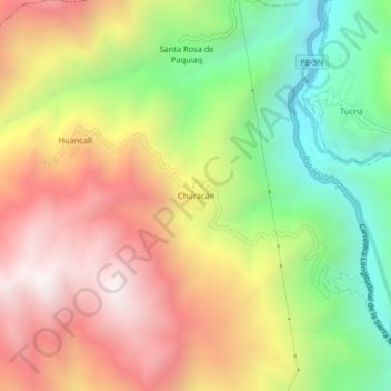
Name: Churacán topographic map, elevation, terrain.
Location: Churacán, San Rafael, Province of Ambo, Huánuco, Peru (-10.26178 -76.18910 -10.22178 -76.14910)
Average elevation: 10,180 ft
Minimum elevation: 7,874 ft
Maximum elevation: 12,484 ft
Thank you for supporting this site ❤️
Make a donation
Make a donation
Gear up for your next adventure:
As an Amazon Associate, this site earns from qualifying purchases at no extra cost to you.