Geolocate

Junction topographic map

Click on the map to display elevation.

About this map

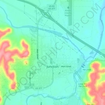
Name: Junction topographic map, elevation, terrain.

Location: Junction, Kimble County, Texas, 76849, United States (30.47801 -99.78970 30.51054 -99.74622)

Average elevation: 1,745 ft

Minimum elevation: 1,650 ft

Maximum elevation: 2,014 ft

Kimble County trails, hiking, mountain biking, running and outdoor activities

Other topographic maps

Click on a map to view its topography, its elevation and its terrain.

Telegraph

United States > Texas > Kimble County

Average elevation: 1,991 ft

Junction

United States > Texas > Kimble County > Junction

Average elevation: 1,808 ft

Noxville

United States > Texas > Kimble County > Noxville

Average elevation: 2,103 ft

Gear up for your next adventure:

🔪Outdoor Multitools - Essential survival tools for gear repair and field use
🔭Compact Binoculars - HD vision for scouting terrain and identifying distant landmarks
🌲Outdoor Survival Books - Best books on survival skills
🪶Thermal Camp Blanket - Extra warmth for cold nights
☀️Outdoor Sunscreen - High protection sunscreen for outdoor activities

As an Amazon Associate, this site earns from qualifying purchases at no extra cost to you.