
Junction topographic map
Click on the map to display elevation.
About this map
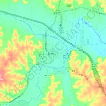
Name: Junction topographic map, elevation, terrain.
Location: Junction, Kimble County, Texas, 76849, United States (30.44936 -99.81201 30.52936 -99.73201)
Average elevation: 1,808 ft
Minimum elevation: 1,637 ft
Maximum elevation: 2,192 ft
Kimble County trails, hiking, mountain biking, running and outdoor activities