Geolocate

Welton topographic map

Click on the map to display elevation.

About this map

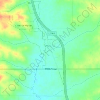
Name: Welton topographic map, elevation, terrain.

Location: Welton, Clinton County, Iowa, United States (41.89760 -90.61026 41.91648 -90.59048)

Average elevation: 725 ft

Minimum elevation: 676 ft

Maximum elevation: 810 ft

Clinton County trails, hiking, mountain biking, running and outdoor activities

Gear up for your next adventure:

🚑Emergency Bivvies - Heat-reflective sleeping bags for survival situations
🔌USB Car Charger - Car charger for on‑the‑go power needs
🧭Pro Hiking Compasses - High-accuracy liquid-filled compasses for topographic orientation
🖼️Topo Map Wall Art - Decorative topographic prints of famous peaks and regions
🧭Compass with Lanyard - Easy‑carry compass for navigation

As an Amazon Associate, this site earns from qualifying purchases at no extra cost to you.