
Thank you for supporting this site ❤️
Make a donation
Make a donation
Gear up for your next adventure:
As an Amazon Associate, this site earns from qualifying purchases at no extra cost to you.
Kivaa topographic map
Click on the map to display elevation.
Thank you for supporting this site ❤️
Make a donation
Make a donation
Gear up for your next adventure:
As an Amazon Associate, this site earns from qualifying purchases at no extra cost to you.
About this map
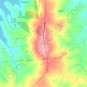
Name: Kivaa topographic map, elevation, terrain.
Location: Kivaa, Kivaa ward, Masinga, Machakos County, Eastern, Kenya (-0.87473 37.67567 -0.83473 37.71567)
Average elevation: 3,481 ft
Minimum elevation: 3,287 ft
Maximum elevation: 3,707 ft
Thank you for supporting this site ❤️
Make a donation
Make a donation
Gear up for your next adventure:
As an Amazon Associate, this site earns from qualifying purchases at no extra cost to you.