Geolocate

Daisy topographic map

Click on the map to display elevation.

About this map

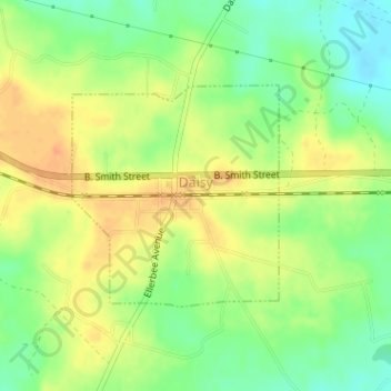
Name: Daisy topographic map, elevation, terrain.

Location: Daisy, Evans County, Georgia, United States (32.14320 -81.84467 32.15854 -81.82777)

Average elevation: 135 ft

Minimum elevation: 69 ft

Maximum elevation: 190 ft

Evans County trails, hiking, mountain biking, running and outdoor activities

Gear up for your next adventure:

🚁Photography Drones - Capture stunning aerial views of landforms and topography
🥾Men's Hiking Boots - Durable, waterproof footwear for rugged terrain and steep inclines
💧Water Filtration Bottles - Safely drink from streams and lakes while exploring
🧥Waterproof Jacket for Hiking - Breathable and rugged rain jacket for outdoor excursions
🥾Hiking Shoes - Durable and comfortable shoes for trail hiking

As an Amazon Associate, this site earns from qualifying purchases at no extra cost to you.