
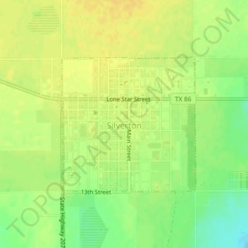
Silverton topographic map
Interactive map
Click on the map to display elevation.
About this map
Name: Silverton topographic map, elevation, terrain.
Location: Silverton, Briscoe County, Texas, United States (34.46410 -101.31290 34.47876 -101.29516)
Average elevation: 3,274 ft
Minimum elevation: 3,219 ft
Maximum elevation: 3,304 ft
Other topographic maps
Click on a map to view its topography, its elevation and its terrain.
Silverton
United States > Texas > Briscoe County
Silverton, Briscoe County, Texas, United States
Average elevation: 3,274 ft
Lake Graham
United States > Texas > Briscoe County
Lake Graham, Briscoe County, Texas, United States
Average elevation: 2,759 ft
Quitaque
United States > Texas > Briscoe County
Quitaque, Briscoe County, Texas, 79255, United States
Average elevation: 2,559 ft