
Make a donation
Gear up for your next adventure:
As an Amazon Associate, this site earns from qualifying purchases at no extra cost to you.
Bergen topographic map
Click on the map to display elevation.
Make a donation
Gear up for your next adventure:
As an Amazon Associate, this site earns from qualifying purchases at no extra cost to you.
About this map
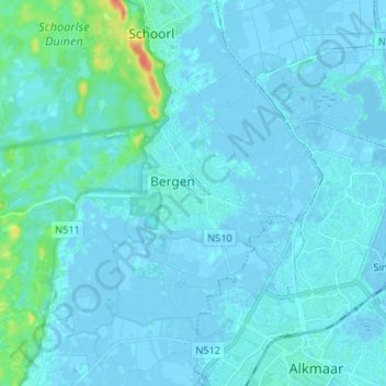
Name: Bergen topographic map, elevation, terrain.
Location: Bergen, Noord-Holland, Nederland, 1861KB, Nederland (52.62766 4.66804 52.70766 4.74804)
Average elevation: 10 ft
Minimum elevation: -13 ft
Maximum elevation: 144 ft
Make a donation
Gear up for your next adventure:
As an Amazon Associate, this site earns from qualifying purchases at no extra cost to you.
Other topographic maps
Click on a map to view its topography, its elevation and its terrain.
Egmond aan den Hoef
Nederland > Noord-Holland > Bergen
Men heeft wel gedacht dat de benaming Egmond zou verwijzen naar de monding van een watertje Egg of Egge dat ter hoogte van de Egmonden in de zee uitmondde. Mogelijk was dit dan een zijtak van de Rekere of zelfs van het IJ. Ook zou de benaming mogelijk verwijzen naar het adellijke huis Egmont. Minder…
Average elevation: 10 ft
Schoorlse Duinen
Nederland > Noord-Holland > Bergen
In augustus 2022 werd in de Schoorlse Duinen een officieus temperatuurrecord gemeten. In de ochtend van 7 augustus 2022 daalde de temperatuur op 10 cm hoogte tot −0,5 °C. Het was de allereerste (bevestigde) keer dat het tijdens de hondsdagen in Nederland vroor. Het vorige laagterecord tijdens de hondsdagen…
Average elevation: 26 ft
Make a donation
Gear up for your next adventure:
As an Amazon Associate, this site earns from qualifying purchases at no extra cost to you.