
Thank you for supporting this site ❤️
Make a donation
Make a donation
Gear up for your next adventure:
As an Amazon Associate, this site earns from qualifying purchases at no extra cost to you.
Karunagapally topographic map
Click on the map to display elevation.
Thank you for supporting this site ❤️
Make a donation
Make a donation
Gear up for your next adventure:
As an Amazon Associate, this site earns from qualifying purchases at no extra cost to you.
About this map
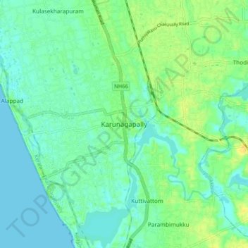
Name: Karunagapally topographic map, elevation, terrain.
Location: Karunagapally, Karunagappally, Kollam, Kerala, 690518, India (9.01514 76.49542 9.09514 76.57542)
Average elevation: 26 ft
Minimum elevation: 0 ft
Maximum elevation: 69 ft
Thank you for supporting this site ❤️
Make a donation
Make a donation
Gear up for your next adventure:
As an Amazon Associate, this site earns from qualifying purchases at no extra cost to you.