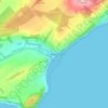
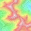
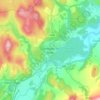
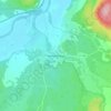
Ardnamurchan topographic map
Click on the map to display elevation.
Ardnamurchan
The north western corner of Ardnamurchan consists of a lopolith (previously interpreted as a ring dyke) that has been exposed at the surface. Evidence for such a structure can be identified from the phenocrysts in the rock exposures around the area of interest which show plagioclase crystals aligned towards the centre of the complex, an alignment caused by magmatic flow within a lopolith. Relatively small areas of lava that were ejected onto the surface are found in some parts of the peninsula, close to the inner edges of the area of interest. The sub-concentric rings of the geologic structure can easily be seen in satellite photographs and on topographic maps, though they are less obvious on the ground. At least seven other similar complexes of the same tectonic episode exist along the west coast of Britain, and these are popular sites for many university geological training courses.
About this map

Name: Ardnamurchan topographic map, elevation, terrain.
Location: Ardnamurchan, Highland, Scotland, United Kingdom (56.67244 -6.22788 56.78470 -5.77770)
Average elevation: 240 ft
Minimum elevation: -3 ft
Maximum elevation: 1,663 ft
Other topographic maps
Click on a map to view its topography, its elevation and its terrain.
Scottish Highlands
United Kingdom > Scotland > Highland
The entire region was covered by ice sheets during the Pleistocene ice ages, save perhaps for a few nunataks. The complex geomorphology includes incised valleys and lochs carved by the action of mountain streams and ice, and a topography of irregularly distributed mountains whose summits have similar heights…
Average elevation: 2,976 ft
Ben Nevis
United Kingdom > Scotland > Highland
Ben Nevis has a highland (alpine) maritime (oceanic) polar climate (ET climate in the Köppen classification). Ben Nevis's elevation, maritime location and topography frequently lead to cool and cloudy weather conditions, which can pose a danger to ill-equipped walkers. According to the observations carried…
Average elevation: 2,992 ft
Fort William
United Kingdom > Scotland > Highland
Fort William has an oceanic climate (Cfb) with moderate, but generally cool, temperatures and abundant precipitation. In the towns immediate vicinity, there are significant variations in elevation, which leads to some uninhabited areas near the town having a subpolar oceanic climate (Cfc), or, at the absolute…
Average elevation: 400 ft
Scottish Highlands
United Kingdom > Scotland > Highland
The Scottish Highlands are renowned for their rugged, mountainous terrain that dominates much of the region. Stretching across the northern and central parts of Scotland, the landscape is shaped by ancient geological forces, including the Caledonian Orogeny, which caused significant tectonic collisions…
Average elevation: 2,976 ft

Dingwall
United Kingdom > Scotland > Highland
Dingwall (Scots: Dingwal, Scottish Gaelic: Inbhir Pheofharain [ˈiɲɪɾʲ ˈfjɔhəɾɛɲ]) is a town on the Cromarty Firth in Easter Ross in the Highlands of Scotland. It has enjoyed the status of royal burgh since the 13th century, and its local government is the Highland Council. The town has a population…
Average elevation: 308 ft

Prince Charles's Stone
United Kingdom > Scotland > Highland > Tomatin > Raigbeg
Average elevation: 1,040 ft









Strathpeffer
United Kingdom > Scotland > Highland
It lies in a strath 5 miles (8 km) west of Dingwall, with the elevation ranging from 60 to 120 m (200 to 400 ft) above sea level. Sheltered on the west and north, it has a comparatively dry and warm climate.
Average elevation: 417 ft


Newtonmore
United Kingdom > Scotland > Highland
Newtonmore is located within the Cairngorms National Park, approximately 3 miles (5 km) southwest of Kingussie and 15 miles (24 km) southwest of Aviemore. It is on the northeastern bank of the River Spey, between the River Calder and the Allt Lairaidh, at an altitude of approximately 250 metres (820 ft).
Average elevation: 928 ft