Geolocate

Tanawan topographic map

Click on the map to display elevation.

About this map

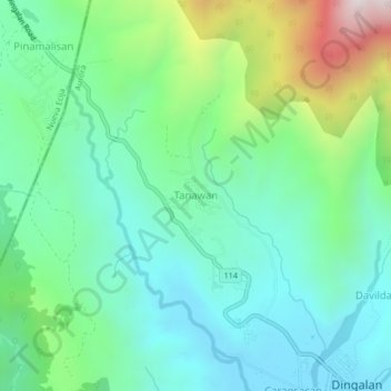
Name: Tanawan topographic map, elevation, terrain.

Location: Tanawan, Dingalan, Aurora, Central Luzon, 3131, Philippines (15.38877 121.35561 15.42877 121.39561)

Average elevation: 948 ft

Minimum elevation: 59 ft

Maximum elevation: 3,402 ft

Other topographic maps

Click on a map to view its topography, its elevation and its terrain.

Dingalan River

Philippines > Aurora > Dingalan

Average elevation: 617 ft

Umiray River

Philippines > Aurora > Dingalan > Abungan

Average elevation: 305 ft

Gear up for your next adventure:

📚Navigation Handbooks - Master the art of reading topographic maps and using a compass
🌲Outdoor Survival Books - Best books on survival skills
📚USA Hiking Guide Books - Top trail guides and map books
🏔️Mountain Trail Maps - High‑detail maps for popular peaks
💧Water Purification System - Clean water on the trail with reliable purifiers

As an Amazon Associate, this site earns from qualifying purchases at no extra cost to you.