
Balk topographic map
Interactive map
Click on the map to display elevation.
About this map
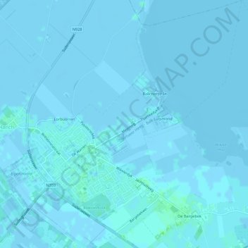
Name: Balk topographic map, elevation, terrain.
Location: Balk, De Fryske Marren, Friesland, Nederland (52.88627 5.56337 52.91896 5.61567)
Average elevation: 0 ft
Minimum elevation: -10 ft
Maximum elevation: 16 ft
Other topographic maps
Click on a map to view its topography, its elevation and its terrain.
Camping
Nederland > Friesland > De Fryske Marren
Camping, De Fryske Marren, Friesland, Nederland, 8493KN, Nederland
Average elevation: -3 ft
Sint Nicolaasga
Nederland > Friesland > De Fryske Marren
Sint Nicolaasga, De Fryske Marren, Friesland, Nederland
Average elevation: 3 ft