Geolocate

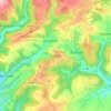
Fleringen topographic map

Click on the map to display elevation.

About this map

Name: Fleringen topographic map, elevation, terrain.

Location: Fleringen, Prüm, Eifelkreis Bitburg-Prüm, Rijnland-Palts, Duitsland (50.18067 6.47346 50.22096 6.52097)

Average elevation: 1,699 ft

Minimum elevation: 1,490 ft

Maximum elevation: 1,939 ft

Other topographic maps

Click on a map to view its topography, its elevation and its terrain.

Buscht

Duitsland > Rijnland-Palts > Eifelkreis Bitburg-Prüm

Average elevation: 1,234 ft

Gear up for your next adventure:

💧Water Filtration Bottles - Safely drink from streams and lakes while exploring
🔦LED Headlamp - Bright and durable LED headlamp for night navigation
🪶Trail Camera - Capture wildlife on your hikes
🧦Hiking Socks - Comfortable socks to prevent blisters on long hikes
🏥Hiking First Aid Kits - Comprehensive medical kits for remote trail injuries

As an Amazon Associate, this site earns from qualifying purchases at no extra cost to you.