
Thank you for supporting this site ❤️
Make a donation
Make a donation
Gear up for your next adventure:
As an Amazon Associate, this site earns from qualifying purchases at no extra cost to you.
Sopore topographic map
Click on the map to display elevation.
Thank you for supporting this site ❤️
Make a donation
Make a donation
Gear up for your next adventure:
As an Amazon Associate, this site earns from qualifying purchases at no extra cost to you.
About this map
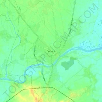
Name: Sopore topographic map, elevation, terrain.
Location: Sopore, Baramulla, Jammu and Kashmir, 193201, India (34.24691 74.42257 34.32691 74.50257)
Average elevation: 5,194 ft
Minimum elevation: 5,164 ft
Maximum elevation: 5,249 ft
Thank you for supporting this site ❤️
Make a donation
Make a donation
Gear up for your next adventure:
As an Amazon Associate, this site earns from qualifying purchases at no extra cost to you.