Geolocate

Anstruther topographic map

Click on the map to display elevation.

About this map

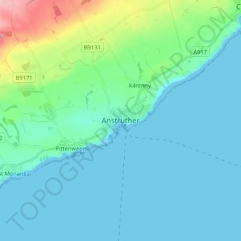
Name: Anstruther topographic map, elevation, terrain.

Location: Anstruther, Fife, Scotland, KY10 3EA, United Kingdom (56.18276 -2.74056 56.26276 -2.66056)

Average elevation: 75 ft

Minimum elevation: 0 ft

Maximum elevation: 466 ft

Other topographic maps

Click on a map to view its topography, its elevation and its terrain.

Rosyth

United Kingdom > Scotland > Fife

Average elevation: 75 ft

Auchtertool

United Kingdom > Scotland > Fife

Average elevation: 371 ft

Gear up for your next adventure:

🪶Wildlife Field Guides - Learn animal tracking and species ID
🏕️Tent Footprint - Protect your tent base from wear
🛡️Bear Spray Outdoor - Protection in bear country hikes
🧭Map Reading Tools - Tools and kits for map navigation
🪶Thermal Camp Blanket - Extra warmth for cold nights

As an Amazon Associate, this site earns from qualifying purchases at no extra cost to you.