
Ko Te He Hatu Mata'a topographic map
Interactive map
Click on the map to display elevation.
About this map
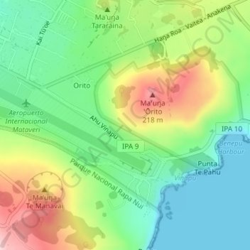
Name: Ko Te He Hatu Mata'a topographic map, elevation, terrain.
Average elevation: 295 ft
Minimum elevation: 0 ft
Maximum elevation: 784 ft
Other topographic maps
Click on a map to view its topography, its elevation and its terrain.
Isla Salas y Gómez
Chile > Valparaiso Region > Easter Island
Isla Salas y Gómez, Easter Island, Easter Island Province, Valparaiso Region, Chile
Average elevation: 0 ft