
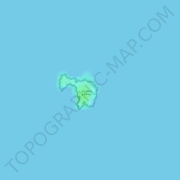
Isla Salas y Gómez topographic map
Interactive map
Click on the map to display elevation.
About this map
Name: Isla Salas y Gómez topographic map, elevation, terrain.
Average elevation: 0 ft
Minimum elevation: 0 ft
Maximum elevation: 23 ft
Isla Salas y Gómez is located 3,210 km west of the Chilean mainland, 2,490 km west of Chile's Desventuradas Islands, and 391 km east-northeast of Easter Island, the closest landmass. Salas y Gómez consists of two rocks, a smaller one in the west measuring 4 hectares in area (270 meters north-south, 200 meters east-west), and a larger one in the east measuring 11 ha (500 meters north-south, 270 meters east-west), which are connected by a narrow isthmus in the north, averaging approximately 30 meters in width. The total area is approximately 15 hectares (0.15 km²), and the total length northwest-southeast is 770 meters. Its highest point, 30 meters above sea level, is in the south of the eastern rock, less than 30 meters from the shore, above a 10 meter high cliff. The highest elevation on the western rock is 26 meters.
Other topographic maps
Click on a map to view its topography, its elevation and its terrain.
Ko Te He Hatu Mata'a
Chile > Valparaiso Region > Easter Island
Ko Te He Hatu Mata'a, Easter Island, Easter Island Province, Valparaiso Region, 2770000, Chile
Average elevation: 295 ft