
Manouba topographic map
Interactive map
Click on the map to display elevation.
About this map
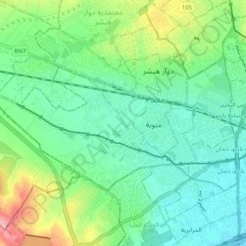
Name: Manouba topographic map, elevation, terrain.
Location: Manouba, La Manouba, Tunisie (36.79582 10.04790 36.82753 10.11917)
Average elevation: 157 ft
Minimum elevation: 36 ft
Maximum elevation: 466 ft
Other topographic maps
Click on a map to view its topography, its elevation and its terrain.