
Longdong topographic map
Interactive map
Click on the map to display elevation.
About this map
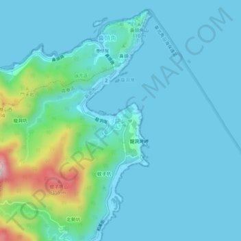
Name: Longdong topographic map, elevation, terrain.
Location: Longdong, New Taipei, 22451, Taiwan (25.09097 121.89903 25.13097 121.93903)
Average elevation: 177 ft
Minimum elevation: 0 ft
Maximum elevation: 1,250 ft
Other topographic maps
Click on a map to view its topography, its elevation and its terrain.
觀景平台
Taiwan > New Taipei > Longdong
觀景平台, 龍洞灣岬步道, Hemei Village, Gongliao District, Longdong, New Taipei, 22451, Taiwan
Average elevation: 135 ft