Geolocate

Ponte Tavollo topographic map

Click on the map to display elevation.

About this map

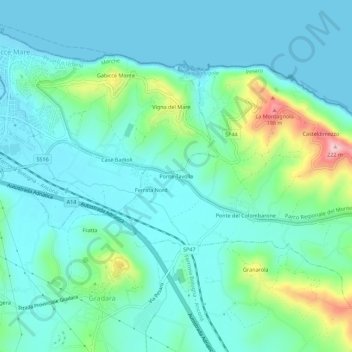
Name: Ponte Tavollo topographic map, elevation, terrain.

Location: Ponte Tavollo, Pesaro, Pesaro e Urbino, Marche, 61012, Italy (43.93269 12.76298 43.97269 12.80298)

Average elevation: 141 ft

Minimum elevation: -3 ft

Maximum elevation: 705 ft

Gear up for your next adventure:

🏥Hiking First Aid Kits - Comprehensive medical kits for remote trail injuries
🔌USB Car Charger - Car charger for on‑the‑go power needs
👖Convertible Hiking Pants - Versatile zip-off pants for changing altitudes and temperatures
🪶Multi‑Purpose Knife - Useful blade for camp and trail
🪶Wildlife Field Guides - Learn animal tracking and species ID

As an Amazon Associate, this site earns from qualifying purchases at no extra cost to you.