
Anna Maria topographic map
Interactive map
Click on the map to display elevation.
About this map
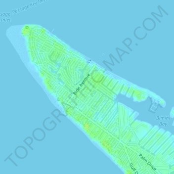
Name: Anna Maria topographic map, elevation, terrain.
Location: Anna Maria, Manatee County, Florida, 34216, United States (27.51938 -82.74652 27.53934 -82.71955)
Average elevation: 7 ft
Minimum elevation: -3 ft
Maximum elevation: 36 ft
Florida trails, hiking, mountain biking, running and outdoor activities