
新泾镇 topographic map
Interactive map
Click on the map to display elevation.
About this map
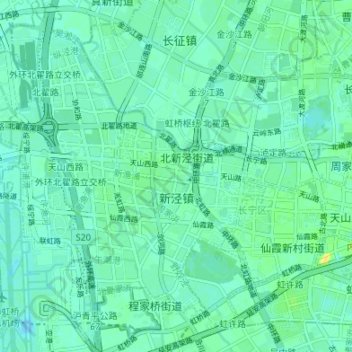
Name: 新泾镇 topographic map, elevation, terrain.
Location: 新泾镇, 长宁区, 上海市, 200335, 中国 (31.18864 121.33389 31.24613 121.38496)
Average elevation: 20 ft
Minimum elevation: -7 ft
Maximum elevation: 66 ft
Other topographic maps
Click on a map to view its topography, its elevation and its terrain.