Geolocate

Newfoundland topographic map

Click on the map to display elevation.

About this map

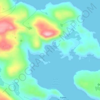
Name: Newfoundland topographic map, elevation, terrain.

Location: Newfoundland, Newfoundland and Labrador, Canada, Rotten Row (47.65868 -56.17829 47.66299 -56.17061)

Average elevation: 148 ft

Minimum elevation: 0 ft

Maximum elevation: 666 ft

Other topographic maps

Click on a map to view its topography, its elevation and its terrain.

Spot Pond

Canada > Newfoundland and Labrador

Average elevation: 387 ft

LaScie

Canada > Newfoundland and Labrador

Average elevation: 322 ft

Daniels Gulch

Canada > Newfoundland and Labrador

Average elevation: 1,522 ft

The Peak

Canada > Newfoundland and Labrador

Average elevation: 220 ft

Roundabout

Canada > Newfoundland and Labrador

Average elevation: 213 ft

Botwood

Canada > Newfoundland and Labrador > Botwood

Average elevation: 56 ft

The Cabox

Canada > Newfoundland and Labrador

Average elevation: 2,290 ft

Boat Harbour

Canada > Newfoundland and Labrador

Average elevation: 282 ft

White Horse

Canada > Newfoundland and Labrador

Average elevation: 325 ft

Mount Caubvick

Canada > Newfoundland and Labrador

Average elevation: 4,173 ft

Gear up for your next adventure:

💧Water Purification System - Clean water on the trail with reliable purifiers
🧣Merino Neck Gaiters - Multi-functional headwear for wind and sun protection
🛡️Bear Spray Outdoor - Protection in bear country hikes
📷Action Camera - Capture your outdoor adventures in HD
🎒Hydration Pack - Hands‑free water reservoir for long hikes

As an Amazon Associate, this site earns from qualifying purchases at no extra cost to you.