Geolocate

Simunjan topographic map

Click on the map to display elevation.

About this map

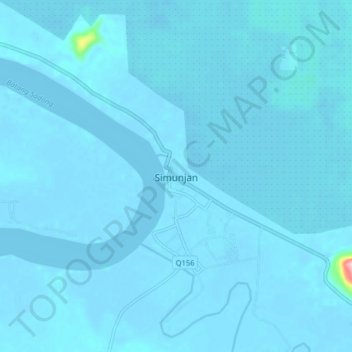
Name: Simunjan topographic map, elevation, terrain.

Location: Simunjan, Samarahan Division, Sarawak, Malaysia (1.35513 110.71125 1.43513 110.79125)

Average elevation: 10 ft

Minimum elevation: -23 ft

Maximum elevation: 607 ft

Gear up for your next adventure:

🔥Camping Stove - Portable stove for camping and backcountry cooking
🥾Men's Hiking Boots - Durable, waterproof footwear for rugged terrain and steep inclines
📌Outdoor GPS Map App - Apps and devices for digital topographic navigation
💧Water Filtration Bottles - Safely drink from streams and lakes while exploring
📚Navigation Handbooks - Master the art of reading topographic maps and using a compass

As an Amazon Associate, this site earns from qualifying purchases at no extra cost to you.