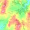
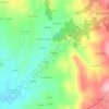
Pidre topographic map
Click on the map to display elevation.
About this map

Name: Pidre topographic map, elevation, terrain.
Location: Pidre, Palas de Rei, Ulloa, Lugo, Galicia, España (42.81667 -7.95598 42.83881 -7.90479)
Average elevation: 1,598 ft
Minimum elevation: 1,463 ft
Maximum elevation: 1,818 ft
Other topographic maps
Click on a map to view its topography, its elevation and its terrain.


Complexo Castrexo do Castro de Seoane
España > Galicia > Ulloa > Antas de Ulla > Sendelle
Average elevation: 1,785 ft