
Tahoe Valley topographic map
Click on the map to display elevation.
About this map
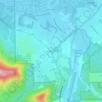
Name: Tahoe Valley topographic map, elevation, terrain.
Average elevation: 6,348 ft
Minimum elevation: 6,227 ft
Maximum elevation: 7,142 ft
El Dorado County trails, hiking, mountain biking, running and outdoor activities
Other topographic maps
Click on a map to view its topography, its elevation and its terrain.
South Lake Tahoe-El Dorado Recreation Area
United States > California > El Dorado County > South Lake Tahoe > Bijou
Average elevation: 6,250 ft