Geolocate

Kullan topographic map

Click on the map to display elevation.

About this map

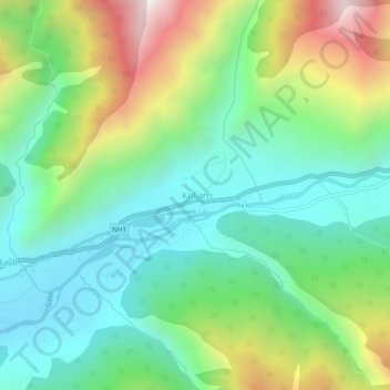
Name: Kullan topographic map, elevation, terrain.

Location: Kullan, Kangan, Ganderbal District, Jammu and Kashmir, India (34.24910 75.12923 34.28910 75.16923)

Average elevation: 8,297 ft

Minimum elevation: 6,972 ft

Maximum elevation: 11,073 ft

Gear up for your next adventure:

🔭Telescopic Hiking Pole - Adjustable pole for hiking stability
📚USA Hiking Guide Books - Top trail guides and map books
💧Water Filtration Bottles - Safely drink from streams and lakes while exploring
📱Solar Portable Charger - Solar power bank for charging devices off‑grid
❄️Traction Cleats - Prevent slips on icy trails during winter hikes

As an Amazon Associate, this site earns from qualifying purchases at no extra cost to you.