
Thank you for supporting this site ❤️
Make a donation
Make a donation
Gear up for your next adventure:
As an Amazon Associate, this site earns from qualifying purchases at no extra cost to you.
Zaarour topographic map
Click on the map to display elevation.
Thank you for supporting this site ❤️
Make a donation
Make a donation
Gear up for your next adventure:
As an Amazon Associate, this site earns from qualifying purchases at no extra cost to you.
About this map
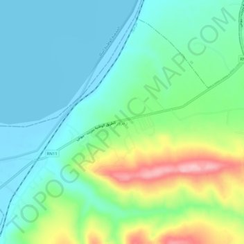
Name: Zaarour topographic map, elevation, terrain.
Location: Zaarour, الزعرور, معتمدية تينجة, Bizerte, 7050, Tunisia (37.09969 9.72551 37.13969 9.76551)
Average elevation: 144 ft
Minimum elevation: -20 ft
Maximum elevation: 531 ft
Thank you for supporting this site ❤️
Make a donation
Make a donation
Gear up for your next adventure:
As an Amazon Associate, this site earns from qualifying purchases at no extra cost to you.