
Thank you for supporting this site ❤️
Make a donation
Make a donation
Gear up for your next adventure:
As an Amazon Associate, this site earns from qualifying purchases at no extra cost to you.
Um al Amad topographic map
Click on the map to display elevation.
Thank you for supporting this site ❤️
Make a donation
Make a donation
Gear up for your next adventure:
As an Amazon Associate, this site earns from qualifying purchases at no extra cost to you.
About this map
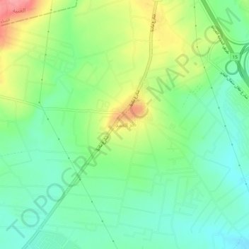
Name: Um al Amad topographic map, elevation, terrain.
Location: Um al Amad, Jizah Sub-District, Jizah District, Amman, Jordan (31.76333 35.88000 31.80333 35.92000)
Average elevation: 2,533 ft
Minimum elevation: 2,421 ft
Maximum elevation: 2,733 ft
Thank you for supporting this site ❤️
Make a donation
Make a donation
Gear up for your next adventure:
As an Amazon Associate, this site earns from qualifying purchases at no extra cost to you.