
Make a donation
Gear up for your next adventure:
As an Amazon Associate, this site earns from qualifying purchases at no extra cost to you.
Ith topographic map
Click on the map to display elevation.
Make a donation
Gear up for your next adventure:
As an Amazon Associate, this site earns from qualifying purchases at no extra cost to you.
Ith
Das Naturschutzgebiet erstreckt sich auf einer Länge von rund 22 Kilometern und stellt die höheren Lagen einschließlich der Kammlagen des Ith unter Schutz, welche von einem der größten Kalkbuchen- und Schluchtwaldgebiete in Niedersachsen eingenommen werden. Die Buchenwälder im Naturschutzgebiet sind insbesondere als Waldmeister-Buchenwald, aber auch als Orchideen-Buchenwald ausgeprägt. Sie stellen sich überwiegend als naturnahe Waldgesellschaften dar. Daneben sind Schlucht- und Hangmischwälder zu finden. Kleinflächig kommen auch standortfremde Nadel- und Laubbaumaufforstungen vor.
Make a donation
Gear up for your next adventure:
As an Amazon Associate, this site earns from qualifying purchases at no extra cost to you.
About this map
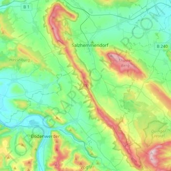
Name: Ith topographic map, elevation, terrain.
Average elevation: 591 ft
Minimum elevation: 220 ft
Maximum elevation: 1,572 ft
Make a donation
Gear up for your next adventure:
As an Amazon Associate, this site earns from qualifying purchases at no extra cost to you.