
Wachenheim topographic map
Interactive map
Click on the map to display elevation.
About this map
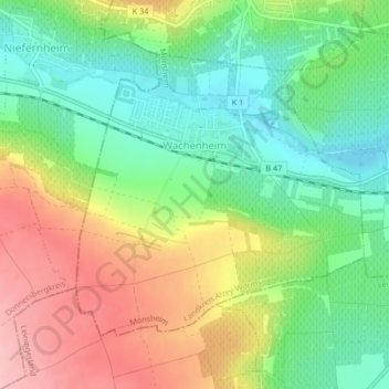
Name: Wachenheim topographic map, elevation, terrain.
Average elevation: 676 ft
Minimum elevation: 459 ft
Maximum elevation: 974 ft
Other topographic maps
Click on a map to view its topography, its elevation and its terrain.
Alzey
Duitsland > Rijnland-Palts > Landkreis Alzey-Worms
Alzey, Landkreis Alzey-Worms, Rijnland-Palts, Duitsland
Average elevation: 728 ft
Flonheim
Duitsland > Rijnland-Palts > Landkreis Alzey-Worms > Flonheim
Flonheim, Alzey-Land, Landkreis Alzey-Worms, Rijnland-Palts, Duitsland
Average elevation: 568 ft