Geolocate

El Consuelo topographic map

Click on the map to display elevation.

About this map

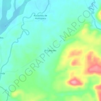
Name: El Consuelo topographic map, elevation, terrain.

Location: El Consuelo, Chonta Punta, Tena, Napo, Ecuador (-0.93588 -77.32907 -0.89588 -77.28907)

Average elevation: 1,089 ft

Minimum elevation: 961 ft

Maximum elevation: 1,401 ft

Gear up for your next adventure:

🌡️Portable Weather Meter - Track weather conditions on the trail
🌐World Map Poster - Decorative world maps with topographic info
🦺Reflective Outdoor Gear - Safety gear for low‑light conditions
🥾Men's Hiking Boots - Durable, waterproof footwear for rugged terrain and steep inclines
🎒Gear Packing Cubes - Organize your backpack efficiently

As an Amazon Associate, this site earns from qualifying purchases at no extra cost to you.