
Aguanish topographic map
Interactive map
Click on the map to display elevation.
About this map
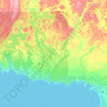
Name: Aguanish topographic map, elevation, terrain.
Location: Aguanish, Minganie, Côte-Nord, Quebec, Canada (50.20844 -62.54764 50.46781 -61.90069)
Average elevation: 213 ft
Minimum elevation: -7 ft
Maximum elevation: 751 ft