Geolocate

Basar topographic map

Click on the map to display elevation.

Basar

Basar is located at 27°59′N 94°40′E / 27.983°N 94.667°E / 27.983; 94.667. It has an average elevation of 578 meters above mean sea level and has pleasantly cold weather.

Wikipedia (CC-BY-SA 3.0)

About this map

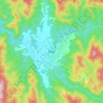
Name: Basar topographic map, elevation, terrain.

Location: Basar, Basar ADC, Lepa Rada, Arunachal Pradesh, India (27.94312 94.64794 28.02312 94.72794)

Average elevation: 2,510 ft

Minimum elevation: 1,870 ft

Maximum elevation: 3,842 ft

Gear up for your next adventure:

🍳Camping Cook Set - Complete cookware for outdoor meals
🔥Plasma Lighters - Windproof lighters that work in any weather condition
🪶Trail Camera - Capture wildlife on your hikes
🧣Merino Neck Gaiters - Multi-functional headwear for wind and sun protection
🛰️Handheld GPS Units - Professional satellite navigators for precise backcountry mapping

As an Amazon Associate, this site earns from qualifying purchases at no extra cost to you.